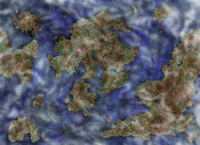
It didn't feel adequate to me becuase I didn't have the measurement systems finished. I figured out a way to fix my little map problem. I decided I'd have it be known that the circumference is 7.9 yér at the equator. Then a person would know by reading it that the map would get smaller towards the top and bottom. Problemo fixed!
For the past 2-4 hours, I've been working on the satellite view of Zanguin and the solar system view. They turned out spectacular, in my opinion. I used Photoshop 7.0 to create the satellite view and a combination of Gimp 2.6.8 and PS to create the solar system view. Check it out!
I'm very pleased with how they turned out! :) The only map that is making the cut (hopefully) is the physical-political view. I really like that one and I feel that it's vital for my readers to be able to see what Zanguin looks like. Don't you? ;)
Here's a sneak-peak of the measurement systems:
Radius = 12,578.910 me
Diameter = 25157.823 me
Circumference = 7.9 yér
Volume = 124.880 nul
1 mm = 16.085 po
1 cm = 1.608 po
1 in = 4.085 po
1 ft = 4.903 hö
1 yd = 14.709 hö
1 mi = 2.589 me
1 km = 1.6 m
1°F =0.471 ik
Miyäyu isto van,
Michael.


No comments:
Post a Comment
Let me know what is on your mind !